Sunday, April 15, 2018
1996 Flooding Aftermath in Rainier, Oregon
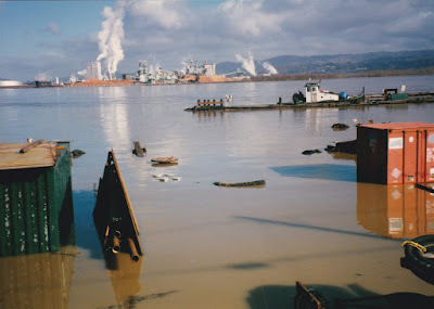
My previous post featured pictures my dad took of the flooding in Rainier, Oregon, in February 1996. This post features pictures I took myself of the flooding aftermath a day or two later, before the water had completely receded. This first picture shows the flooded Foss Maritime yard on the Columbia River, which had barely receded.
This building at the Foss Maritime yard was clearly flooded.
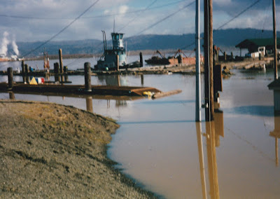
The level of the Columbia River was all the way up to the bottom of the Norris dock, which was usually far above the water.
Other low-lying riverfront property was also flooded, including the home of Riverside Auto Body.
This picture of a flooded trailer shows just how high the water was.
The Rainier Marina was inaccessible, due to the end of the main dock being anchored to the ground, although even if it floated, it wouldn't have been long enough to reach dry land in this case.
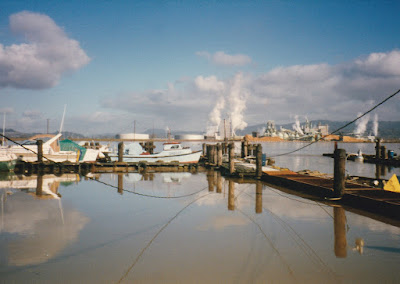
The high water level lifted the floating docks at the Rainier Marina almost to the top of the pilings.
All of the boats moored at the Rainier Marina would remain inaccessible until the water receded.
The Columbia River came very close to the rear corner of the Rainier Eagles lodge.
The Burlington Northern Railroad trestle over Fox Creek was being used by pedestrians to reach the park, as the normal pathway was still flooded.
The culvert that carried Fox Creek from the railroad trestle to the Columbia River was still completely underwater. It was allowing the flooded creek to slowly drain into the river, however, and a tiny whirlpool could be seen from the railroad trestle, marking the location of the start of the culvert.
While still obviously flooded, the creek bed between the railroad trestle and the highway had noticeably receded since the height of the flooding.
I have to admit I like the way the sky is reflected in the perfectly still floodwater in these pictures.
This view from the railroad trestle looking toward the Columbia River shows that the water had only just started to reveal the paved pathway to the park.
A lot of Rainier Riverfront Park was still flooded. Note that the water level is up to the seat of the bench on the right.
At least Crazy B's Café had a sense of humor about the situation.
Though the waters had receded considerably at Rainier Elementary School, the field was still flooded. Note on the left that the water is now several feet below West 2nd Street, which was underwater at the height of the flooding.
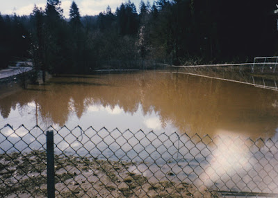
This view through the trees from the top of the Fox Creek Trail behind Rainier Elementary School was an attempt to show how much water was still in Fox Creek. It looked more like a river.
Part of the playground at Rainier Elementary School was still flooded, but the water had receded from most of it, leaving behind a coating of sticky, silty mud.
Here is another view of the Rainier Elementary School playground. A climbing apparatus made of old tires was actually pulled out of the ground during the flooding and now lay on its side. Visible behind the spiral slide are some large equipment tires. There were originally three of these tires lined up in a row. During the flood, the middle tire floated away and can be seen on the far left of the picture. Instead of being put back in its original place, this tire would end up being partially buried in an upright position in another part of the playground.
This is a view of Nice Creek from the Nice Creek Viaduct. Nice Creek is usually barely visible, so the wide, flowing stream pictured here was unusual.
North of the Nice Creek Viaduct, there was still evidence of flooding. At one time, Nice Creek began to widen into a delta at this point that led into the Columbia River. Later, construction of the highway and sand filling made this an isolated lowland that was usually mostly dry.
Just past this point, Nice Creek entered a culvert that takes it under U.S. Highway 30 and Rainier Riverfront Park. This culvert was not as undersized as the Fox Creek culverts, and was usually adequate for the waters of Nice Creek. The high water in the Columbia River, however, probably backed up into the Nice Creek culvert, causing flooding here, where fortunately this lowland area provided space for the extra water.
The floodwater here had also started to recede, leaving behind the same muddy residue as at the Rainier Elementary School playground.
Subscribe to:
Post Comments (Atom)


No comments:
Post a Comment